|
|
ADAMS |
|
|
|
Geographical Features
Location and Boundaries
Adams is a paradise lying on the northeastern wing of the province,
about 114 kilometers away from Laoag City. It is situated at the foot of the Cordillera mountain ranges.
It is bounded by the town of Pagudpud on the west, the province
of Cagayan on the north, the province of Kalinga-Apayao on the east, and the town of Dumalneg on the west.
Land Area and Topography
The town has a land area of 13,825 hectares interspersed with
river valleys, hills and mountain ranges which serve as its barriers. About 96A percent of the total land area are
pasture and forest lands, while the remaining 3.6 percent are agricultural and residential areas. The place is abundant with
wildlife and thickly forested areas, which are about 2,500 feet above sea level.
Climate
Adams has a climate that is very different from that of the rest
of the province. It has a very long rainy season and a very short dry season. This is due to the climatic condition of the
two neighboring provinces that border it.
Likewise, most of the days of the year are cool and cloudy, just
like the weather condition of Baguio City. This is because of its elevated location.
Poblacion
Still on its early stage of development, the poblacion is divided
into three districts, namely: 1, 2 and 3. The municipal hall, a small wooden building erected through the efforts of the people,
is found at the northern part of the poblacion. A few meters away is the medical clinic. Behind the clinic is the Adams Elementary
School consisting of two Marcos-type buildings.
The post office is also in the town proper.
A river that flows at the southern part of the poblacion provides
recreational sites for the people, while the forest serves as a scenic background.
There is no electricity, hence the people still use kingki
(kerosene lamp) and lampara (a native kind of lamp),
However, there is no water problem. A spring development project
was put up by an American agency to meet the water needs of the people.
The town consists of only one barangay, which is sub-divided into
sitios, namely: Bucarot, Siwet, Kabacan, Budabid, Sinidangan, Gubgubeng, Lipay and Maligligay. The sitios are far apart.
Each sitio is peopled with cultural minorities who came from Itneg,
Igorot, Ilocano, and Kalinga-Apayao tribes.
Population
The town has a population of 1,213 (613 males and 600 females)
who mostly belong to the cultural
communities. There are also a few migrants from other places in the Ilocos. The inhabitants are Ilocanos, Papayas, Tinges
and Kanaka-speaking Rigorous. The residents occupy 216 private dwellings.
Town History
It is likened to a paradise, because it is believed to be a perfect
replica of the "Garden of Eden" where Adam and Eve once lived. The first inhabitants belonged to the Kalinga-Apayao tribe.
They cleared the land, tilled the soil and planted abundant root crops like camote (sweet potato), tugui (yam),
and cassava.
Years later, the Igorots from Baguio City and the Tinges from
the neighboring tribes, in their search for a better quality of life, arrived. They chose Adams, because it was rich in natural
resources and life, too, was very easy.
After some years, the civilized people from Bangui, Ilocos Norte;
Ilocos Sur; Parnassian; and Abra also came to settle. They intermarried with the natives until the place became a prosperous
settlement.
It was during the American regime that the place was established
as a municipal district. It was formerly called Adan, but by virtue of an executive order, its name was changed to Adams.
It became a municipality on May 16, 1983 by virtue of Republic
Act No. 337 or the Local Government Code. |
Town Executives
Since its early beginnings, the town has been under only four municipal mayors. The first was Honorable Burawi, an
Itneg who opened the town and effected its civilization Honorable Landok, who continued the development of the town, succeeded
him. Then Honorable Antonio Tarnate took over. The mayor, who was elected on January 18, 1988,is Hon. AIfredo Camacam.
|
BACARRA |
|
|
|
|
|
|
|
Geographical Features
Location and Boundaries
Bacarra is situated at the center of the western side of Ilocos
Norte. It is about 495 kilometers north of Manila and seven kilometers north of Laoag City, the capital of me province. The
town is bounded by Laoag City on the south, by Vintar on the east, Pasuquin on the north, and the China sea-on the west.
It is traversed by the cemented national highway that links the
town to Manila and the Cagayan Valley. Hence, the people can easily avail themselves of the services of the different buses
plying between Bacarra and Laoag and from Laoag to the northern towns of the province, Manila, and Cagayan and Kalinga-Apayao.
Properly maintained feeder roads and wooden or cemented bridges connect the barangays to the poblacion or the national highway.
This makes it easy for small buses, jeepneys, and motorized tricycles to reach even the remotest barangay in the town. Hence,
transportation is not a problem of the people of Bacarra.
Land Area and Topography
Bacarra occupies a land area of about 7,700 hectares. It holds
third rank, after Laoag City and Batac, in size of urban area (1.45 square kilometers). The major portion or its land area
is cultivated and planted with various agricultural crops the whole year round.
The eastern part of the town consists of rolling terrain, while
the western side has narrow strips of flat land. The central part is basically similar to the western part, which gradually
rises up to the eastern boundary with moderate elevation of 50 to 150 feet above Sea level. Low hills, with fine timbers,
run northward on the eastern side of Bacarra.
The eastern part of the municipality has a clay loam soil, while
the western side is generally sandy
Climate
Bacarra experiences five different seasons, wet season from May
to October; and dry season, from November to April. June, July and August are the wettest months. The average annual temperature
is about 27.50c. The warmest period is between April and June, while the coldest season is from December to February.
One main river, the Bacarra-Vintar River, flows into the China
Sea, and several brooks and creeks traverse the different parts of the town. These are harnessed by the people for irrigation.
However, their water supply weakens during the dry season, so that only those at the upper stream are benefited.
Poblacion
The poblacion (town proper), which is about seven kilometers
north of Laoag City and situated along the north bank of the Bacarra-Vintar River, is rectangular. 'The eastern and the western
portions of the southern side of the town proper is eroded yearly by tile Bacarra-Vintar River when it overflows its banks
during the rainy season. This prompted the local government to construct a river control which lessens the erosion.
There is only one main street, the Rizal Street, that stretches
from east to west across the town proper Minor streets are named in honor of the officials who sewed the town. The zoning
plan follows the Mock system. A steel bridge, spanning the narrowest portion of the Bacarra-Vintar River, is at the eastern
approach of the poblacion and is linked with the main street,
The poblacion houses the municipal hall, public plaza, churches,
public theater, private and public school building, public market, health centers, and business establishments.
Barangays
The municipality has 48 barangays, 18 of which constitute the
poblacion.
The barangays in the poblacion are the following: Santa Rita,
Brgy. No.1; San Andres, Brgy. No 2; San Andres, Brgy. No.8; San Simon, Brgy. No. 4, San Simon, Brgy. No.5; San Pedro, Brgy.
No.6; San Pedro, Brgy, No, 7; San Agustin, Brgy. No. 8; San Agustin, Brgy. No, 9; San Vicente, Brgy. No, 10; Santa Filomena,
Brgy, No.11; Santa Filomena, Brgy. No.12; San Gabriel, Brgy. No.13; San Gabriel, Brgy. No.14
San Roque, Brgy. No.15; San Roque, Brgy. No.16; Santo Cristo, Brgy. No. 17; and Santo Cristo, Brgy. No.18. The 25 barangays
outside the town are the following. Bani, Cabusligan, Buyon, Cabaruan, Cabulalaan, Cadaratan, Calioet-Libong, Casilian,
Corocor, Curarig, Duripes, Ganagan, Libtong, Macupit, Nambaran, Natba, Paninaan, Pasngal, Pipias, Pulangi, Pungto, Sangil,
Tambidao, Teppang, and Tubburan.
Population
Bacarra has the fourth largest population among the 22 towns of
Ilocos Norte. Bacarra's population of 4,000 in 1501 increased to 13,064 in 1972 , 20,736 in 1970,22,118 in 1975 and 23,871
in 1980 , distributed in 4.641 households.
The population density of the town was 401.9 in 1970, 428 in 1975
and 452.9 in 1980 The change in population increase was 6.7 percent in 1970-1975 and 5.7 percent in 1975-1980.
Town History
Establishment
The Augustinians founded the town of Bacarra in 1590. It is the
third oldest town in Ilocos Norte. However, Bacarra was officially recognized as a municipality by the Spanish government
in 1778.
The ministry of Bacarra was established by the Augustinians on
June26, 1591 under the patronage of San Andres Apostol, with Vintar, Pasuquin, Bangisan, Banbang, Adang and Bera as its visitas
in the early part of its foundation. However, Bacarra, too, was a visita of Laoag by virtue of an order issued by the Augustinians
on October31, 1603. It again became an independent ministry in 1614.
In 1591, Bacarra was an encomienda which belonged to Captain Castillo
and Andres de Hermosa.
Origin of its name
The origin of the town's name is uncertain. However, attempts
to explain this matter are embodied in folk accounts which are commonly known by the people and are even taught in school
to the pupils. The most popular is the following folktale:
"One day, while some inhabitants were catching fish in
the river, Spaniards who were then passing by asked them the name of the place. Because the fishermen could not understand
them they thought they were asking them the name of the fish they had just caught. So, one of the fishermen answered, "Bacbacarra,
Senor," referring to the fish. From that time on, the place had been called Bacarra.
There are also those who theorize that the name of the town was
derived from the term baca (cow). It is said that in the past, there were vast pasture lands in the locality where
thousands of cows grazed.
Others point cut that the early inhabitants of the place treasured
rice baskets called bacar. Hence, they believe that the native name of the basket could be the term from which the
name of Bacarra was derived.
These folk accounts, aside from trying to explain how the town
got its name, also point out that the original' work force of Bacarra consisted of fishermen, ranchers, farmers, and weavers.
Early Settlers
The early settlers of Bacarra were believed to be Igorots They
occupied the bank of the river. Note the following folk account:
"An Igorot named Baksa-Landok was attracted by the beauty of the
Bacarra River when he went cut hunting in the hills between Bacarra and Laoag. He settled north of the place. Because of the
vast and rich natural resources of The place, Baksa-Landok became prosperous. When other Igorot noticed his prosperous and
happy living more of them occupied different parts or the riverbank. The west central part called Baranio wm settled by one
tribe, and the central part called Parparia was occupied by another tribe, and the other tribe established itself in the eastern
part called Bira.
Town
Executives
Since 1778 to the present (1988) or a span of 210 years, Bacarra
has been administered by 131 town executives, who were either appointed or elected as gobernadorcillos, capitanes municipal,
presidentes and mayores.
Eon Manuel Paras became the first town executive of Bacarra in
1778. While Don Marcelo Dacuycuy was the last town executive under the Spanish colonial rule. However, he continued as president
in 1899 and was replaced by Don Andres Lazo under the American civil government. Don Torcuato Ver was the first mayor under
the Commonwealth of the Philippines that was established in 1925. Meanwhile,
Hon. Justo A. Pilar was the last mayor under the Cornrnonwealth government as well as the first mayor appointed under
the Republic of the Philippines.
Atty. Felix A Rivera who assumed office as mayor in 1948 was the
first elected to mayor under the Republic of the Philippines. Hon. Leonardo
A. Velasco served as mayor of Bacarra for about 20 years during
which the administration greatly increased the income of the town from P68,000 in the 1960's to P837,169.54 in 1984 .
Honorable Philip Velasco was an OIC mayor in 1987. The mayor of
Bacarra in January 18,1988 was Honorable Jose Pilar. |
|
BADOC |
|
|
|
|
|
|
|
Geographical Features
Location and Boundaries
Badoc, the birthplace of the famous Filipino painter, Juan Luna
y Novicio, is the southernmost town of the province of Ilocos Norte and lies 40 kilometers south of Laoag City. Located at
26' and 34' longitude and 49' and 25' latitude lines, it nestles between the Killago mountain ranges on the east and the deep
blue China Sea on the west. It is bounded on the s6uth by Sinait, the northernmost town of Ilocos Sur; on the east, by the
towns of Nueva Era and Pinili; and on the north, by the coastal town of Currimao.
It is about an eight-hour ride from Manila by passenger bus. Being
the gateway to the province from the south, it serves as the show window of historic Ilocos Norte.
Land Area
Badoc has a total land area of 6,660 hectares, which is equivalent
to 2.04 percent of the total land
area of the province. Rut of the said area, 4,309 hectares (64.71 percent) are already developed; 1,312 hectares (19.69 percent)
are forest land, and 1,039 hectares (15.60 percent) are still to be developed.
The developed area is principally composed of agricultural lands
and residential lots, while the forested area consists of communal forests and mountain ranges. The area which can be developed
is composed of lands spread over the mountain sides, those with hilly terrain and those along the seacoast. There is only
one primary water source, the Badoc River, However, it has several tributaries, such as brooks and streams, most of which
become dry during the summer months. The coastline of the west boundaries of the town are stretched along seven coastal barangays
where fishing is one of the principal means of livelihood of the people.
The barangays in the poblacion have a combined area of
68.1 hectares, which represents 1.03 percent of the total land area of the entire town, while the rural barangays have combined
area of 6,591.9 hectares or 98.97 percent of the land surface of Badoc.
Topography
The land surface elevation of the town is higher than that of
the adjacent towns of Currimao and Pinili. Its mountains fall under the secondary forest category and the communal forests
are located within the jurisdiction of Barangays Camanga, Madupayas, Nagrebcan, and Labut. The rest belongs to private individuals.
The terrain of the municipality is generally flat, The mountainous
portions are located at the eastern and southern sections of the town and the highest elevation of the mountains is 441 meters
above sea level.
Mountain slopes fall under the classification of pasture or open
grasslands which is from 20 percent to 40 percent. It is believed that the slope condition of the mountains is a vital factor
that facilitates the drainage of the surface watercourse, like rivers, brooks, and creeks, resulting in the drying of the
irrigation canals during the summer period. However, the people have developed other sources of irrigation.
Most of the irrigated lands are planted to rice, twice or thrice
a year. Among the other crops raised on rotation basis are garlic, Virginia tobacco, onion, corn, beans, mungo and
vegetables. Garlic has become a principal crop of the town because of its good market price. Hence, Badoc is now known as
the garlic town of the North.
The upland areas are planted to ipil-ipil trees, fruit trees and
root crops. However, some portions have been already developed and are being planted with the upland rice variety or with
vegetables.
Climate
The climate of Badoc is characterized by two pronounced seasons,
namely: the dry season (summer months), which usually starts from the month of November and lasts until the month of May;
and the rainy season, from June to October.
Usually, in the later part of May, the advent of the rainy season
is ushered in by occasional drizzles. By June, the rainy season sets in. However, there are times when heavy downpours come
successively for a week or more which suddenly stop until the rice lands get dry to the dismay of the farmers who have to
replant
The two seasons of Badoc, it may be said, are as variable as the
weather itself. During the summer months, particularly in April and May, there are times when the temperature remains high
during the day and even at night, sometimes reaching as high as 40 degrees, Likewise, the cold temperature during the rainy
season is very variable. There are very cold days, especially in January and in February, during which the temperature can
be as low as Oo Centigrade.
Like any other part of Northern Luzon, Badoc is oftentimes visited by typhoons, sometimes even during the months
of November and December. The winds generate heavy downpours that cause the swelling of watercourses. The excess floods wash
out agricultural lands and crops, roads and bridges and other land utilities.
The soil of the town is suited to agriculture, especially that
in wide plains. These areas are verdant with farm crops almost throughout the year. Even the mountain slopes and hilly areas
are used for farming.
Minerals
Badoc is not a mining community. So far, no metallic mineral has
been discovered. There are, however, two non-metallic minerals found within the municipality. The first one is salt, which
is produced through the crude cooking process from the fine sand on a one-kilometer stretch of the Pagsanahan shore. Salt-making
is one of the principal sources of income of many families living in this coastal barangay. The development bf this enterprise
is very feasible through the adoption of easier and faster methods of salt-making.
The second non-metallic mineral is the clay found. on the mountain-side
in Barangay Gabut. Laboratory tests reveal that this kind of clay is good for molding pottery and for the ceramic industry.
Barangays
The town has 31 barangays which are further subdivided into sitios.
There are three poblacion barangays. These are Canaan, Brgy. No.1; Garreta, Brgy. No. 2;and Alogoog, Brgy. No.3.
The other 28 barangays are located in the rural areas, thus they
are referred to as rural barangays. Arranged according to their numbers, they are:
Saud, No. 4-A; Aring, No. 4-B; Pagsanahan Sur, No. 5-A; Pagsanahan
Norte, No. 5-B; Morong, No. 6-A; Paguetpet, No. 6-A; Paguetpet, No. 6-B; Sta Cruz, No. 7-A; Sta Cruz Sur, No. 7-B; Caraltan,
No.8- Palfit, No. 9; Lubigan, No. 10; Labut, No.11; Throd, No.12; Ar- arusip Sur, No. 13.A;Ar-arusip Norte, No. 13-B; Nagreboan,
No.14; Balbaldez, No. 15-A; May, No. 15-B; Madupayas No. 16-A; Camanga, No. 16-B, Parang, No. 17-A; Pasuc, No. 17-B;
Mabusag Norte, No. 18-A; Mabusag Sur, No. 1&B; Napu, No.19; Gabut Norte, No. 20-A; Gabut Sur, No. 20-B, and Lacuben, No
21.
Eight of the 28 rural barangays are along the seacoast. They are
Saud, Aring, Pagsanahan Sur, Pagsanahan Norte, Paguetpet, Gabut Norte, Gabut Sur and Lacuben. Consequently, fishing is one
of the prin4pal means of livelihood of the residents in these barangays.
The nearest rural barangays to the poblacion are: Lacuben, Aring,
Saud, Sta Cruz Norte, Caraitan, Paltit, Mabusag Norte, and Napu, while the farthest arranged as to distance are: Camanga,
Madupayas, Balbaldez and Nagrebean in the east; Gabut Norte and Gabut Sur in the north; Papanahan Sur and Pagsanahan Norte
in the west; and Sta. Cruz Sur in the south. Lacuben, the nearest rqral barangay to the poblacion, is about a kilometer away
from the town proper Camanga, the farthest, is about 11 kilometers away.
Population
The population of the municipality as of 1980 was almost twice
the population indicated in the 1903 census. If we analyze the trend of the growth of population, we can see that the increase
is rather slow. Within a span of 77 years, the population has grown by 9,873 people only.
From 1903 to 1918, the population did not grow, but rather decreased
by 4,367. The reason was not due to calamitous circumstances like the occurrence of pestilence, but due to the creation of
the town of Pinili. Pinili used to be a barangay of Badoc, but with several other neighboring barangays, it became a separate
municipality in 1920. Naturally, during the following census year conducted in 1939, the population of Badoc registered a
marked decrease. Again, from 1948 to 1960, another population drop by 1,363 was registered. The population figures of at least
three barangays were not included. Aside from this, there was also an improper identification of residence done by people
residing along the boundary lines between the towns of Pinili and Badoc and those between Sinait and Badoc.
From 1970 to 1980, population census records show that there was
a gradual increase of population by 7.3 percent or 1,532 persons between the years 1975 and 1980.
The population of the town is distributed among three poblacion
barangays and 28 rural barangays, with a grand total of 22,327 people. The general density rate of the entire town
is three persons to a hectare of land. This indicates that the town has low population density.
In the urban barangays, the total population is 2,567 people living
in an area of 68.1 hectares. This indicates that the population density is 38
persons per hectare of land. The population registered in the rural areas, occupying a total land area of 6,592 hectares,
is 19,760 people. This means that two persons live in or are allocated one hectare of land.
Town History
Establishment
Badoc was established as a pueblo (town) in 1714 by the
Augustinian friars. It is believed that the late founding of the town of Badoc was due to the unsettled peace and security
conditions of the place at the time. 'the Badoc Island, known as “Puro,"
situated about two kilometers seaward from the coastline of the coastal barangay, Paguetpet, was said to be the favorite haven
or hangout of fierce and hostile Moro and Zambal marauders. They stayed long in the island, because they were afraid to move
out to neigh-boring towns which had good security forces.
These ruthless marauders raided repeatedly the undisturbed villages
south of the port of Gaang, Curimao, refraining from moving north near Paoay, whose security force could be strengthened easily
and aided by those from Batac. Their stay greatly contributed to the delay in
the establishment of the town. It was only after the pirate marauders moved out that the town was deemed officially founded.
The establishment of the town as a parish in 1714 was also the
approximate start of the construction of the Spanish built Catholic church, known as the Saint John the Baptist Church. It
is said that the place of the Isneg settlement, wherein the first Spanish missionary team also established camp, was the seat
of the Christianization of the town. This explains why the name Canaan, meaning "refuge of new Christians" was given to the
area. It was also in the place where the church was established and where the first mass was said by Padre de Alvarado, an
Augustinian priest who was the spiritual adviser of the expedition led by the youthful Spanish conquistador, Juan de Salcedo.
The first mass, which was celebrated on June 24, 1572, or more than two centuries before the construction of the Catholic
church, was said in thanks-giving for the peace treaty between Salcedo and the native leaders and was also dedicated to those
who were slain in battle It coincided with the feast day of Saint John the Baptist, who was made Badoc's patron saint.
Folks recounted that the huge and imposing house of worship, made
of bricks and stones and roofed with Spanish -style corrugated clay tiles, was constructed under the Spanish forced labor
decree. It was also said that not a single drop of water -was used in the whole construction process. The concreting materials
were made purely of sugarcane juice, which the natives contributed under the "family quota system." Now, the church, already
weather-beaten but unweakened by time and age is the sanctuary and shrine of
La Virgen Milagrosa de Badoc, because it was found in the year 1620 by Badoc and Sinait fishermen along the shore of Lugo
village. The image, encased in a wooden box, together with a life-sized picture of Santo Cristo Milagroso, the statue of angels
and one violin, were given to the Sinait fishermen as their share from the mysterious discovery, Since, then, the Sinait Catholic
church has become the shrine of the Santo Cristo Milagroso.
During the Spanish and early American regimes, the small and sleepy
town of Badoc was practically an illiterate and backward pueblo. However, as time passed, this sleepy town steadily
grew. It has now become a fourth class municipality with an annual income of about P500,000. It has also become one of the
most literate towns in the province, with the entire populace growing education-conscious. At the same time, it has now a
very progressive socio-economic status due to the extensive agricultural and commercial activities of the people.
As the hometown of the famous Luna brothers, Juan Luna and Antonio
Luna, Badoc has become a tourist attraction in the Ilocos region. The reconstructed house of Juan Luna, now popularly
known as the Juan Luna Historical Landmark, with its original grandeur and antiquity restored: the Luna Park which is considered
the most spacious and ideally situated, and one of the most beautiful parks in Northern Luzon; and the two-century-old Catholic
church which is the shrine of the La Virgen Milagrosa de Badoc, are drawing more visitors and tourists almost everyday.
Origin of its Name
Before the coming of the Spanish colonizers, the place was inhabited
by some Isneg families. These were the earliest settlers and they established their huts in a clearing called Canaan, situated
along the bank of the brook which was known as Pagdanuman (water source). All around the settlement was a thick growth of
a native weed known to the settlers as bado-badoc. This weed was very valuable to the Itnegs, because its flowers,
dipped in oil extracted by cooking process from the kernel of the bittaog (palomaria) fruit, was used to light their
huts at night and the stem and elongated leaves were used in making the walls and fences of their homes.
In 1572, the Spaniards conducted intensive Christianization missions
and Spanish soldiers were cruising along the Pagdanuman Brook, looking for a clearing wherein they could put up their camp
when they came upon the Isneg settlement, In a very friendly manner, they approached the native settlers and requested that
they be allowed to make camp near their settlement. But this could only be made possible by clearing an area of the thick
growth of the Badoc-badoc weeds.
Because of the language barrier, the Spaniards signified their
intention by the use of signs. The soldiers pointed to the area that they desired to weed out for their camp site, At the
same time, they signalled their request for help in the clearing activities. Unable to understand what the Spaniards desired,
and believing that they merely wanted to know the name of the weed, the leader of the settlement swung one of his arms while
pointing to the thick growth and said: "Bado-badoc, bado-badoc." The leader
of the team recorded these words; hence, the town was called Badoc.
Later; in accordance with an understanding made between the settlers
and the missionaries. the area adjacent to the Isneg settlement was cleared of the bado-badoc weed. In spite of the
good intentions of the missionary team, that was to make camp and have a center for their Christianization operations, the
Isneg families became wary and suspicious due to the presence of armed Spanish soldiers. One night, under the cover of darkness,
the entire Isneg group moved out eastward until they reached Ugis, a barangay of the town of Nueva Era ,which is adjacent
to the easternmost barangay of Badoc and made their own settlement in the area. Up to this time, the Isneg still live in Ugis.
Town Executives
Before the
coming of the Spaniards in the Philippines, the natives were ruled by chiefs, known as datus, who were in charge of
a number of families from less than 20 to 100. The group of families ruled by the datu made up as barangay. However,
available historical records do not contain any information as to who were the chiefs of the place known as Badoc |
|
BANGUI |
|
|
|
|
|
|
|
Geographical Features
Location and Boundaries
Bangui is located at the northwestern part of the province, 64
kilometers away from Laoag City. Its boundaries are the 'solo River of Pagudpud on the north, the town of Vintar on the south,
Dumalneg on the east and the town of Burgos on the west.
Land Area and Topography
It has an aggregate land area of 250 square kilometers or 50,000
hectares. More than three-fourths of the total land area are mountains and waters. Northwest of the town is a beautiful bay
and to the east and southern part are verdant mountains and hills with fertile valleys at their feet, crisscrossed by rivers
that flow towards the blue China sea.
Climate
The climatic condition of the town is very different from those
of the rest of the province. The rainy season is long, because it is affected by the climatic condition of Cagayan Valley,
while the dry season is very short.
Poblacion
It is situated at the center of the town, traversing the national
road, Some roads and streets are still uncemented,
There are no big edifices, however, some houses are modem, equipped
with the latest appliances and furniture,
The newly built public market consists of sari-sari stores and
groceries. The municipal hall is a two-storey building situated along the national road. Beside it is the municipal auditorium
used during town fiestas and other festive occasions. A telegraph system facilitates faster communication. A complete elementary
school, the building of which is yet to be renovated, is situated near the coastline.
The Health Center and Puericulture Center are also within the
poblacion, together with the Bangui District Hospital, which is located
at the southern part of the poblacion.
Barangays
There are 15 developing barangays of the town, one of which is
within the poblacion. These barangays are the following: San Lorenzo, Brgy, 1, is the poblacion barangay inhabited
by sturdy people. Nagbalagan, Brgy, 2, is the oldest barangay, and is located just a walking distance east of the poblacion.
Fresh water fishes and shells can be gathered from its running water, Abaca,
Brgy. 3, is famous for its rope products. Masikil, Brgy. 4, is where the Hacienda Cacafean is located, Banban, Brgy. 5, is
a prosperous barangay which produces garlic, tobacco, poultry, swine, and cattle. Lanao, Brgy. 6, is the second oldest and
is the richest barangay where enterprising and adventurous people live. Baruyen, Brgy. 7, where the zigzag road is located,
is considered the gate of Bangui at the south. San Isidro, Brgy. 8, is located at the foot of the mountain where the 'solo
Irrigation Dam is located. Malasin, Brgy. 9, is famous for its native fish like dalag, paltat and tilapia. Taguipuro, Brgy.
10, is a former sitio of Baruyen. It is virtually an island, because it is at the center of two rivers.
Payac, Brgy. 11, is the farthest barangay from the townproper.
Manayon, Brgy. 12, is an infant barangay in the east where hardworking and adventurous people live. Utol, Brgy, 13, is
situated along the road, It is a newly organized barangay and the gateway to Dadaor and Taguipuro. Bacsil, Brgy. 14,
is east of the Sentinela hill, and Dadaor, Brgy. 15, is located at the top of a hill.
Population
The municipality had a population of 11,132 people in 1980. In
1986, the population had increased to 11,545 people, who are widely distributed in each barangay.
Town History
The municipality of Bangui was organized in 1786, 265 years after
Ferdinand Magellan set foot on the Philippine islands. Fernandez, a business-man, founded it. He gathered and led the Itnegs
against the invading pirates, who frequently raided the community. It was here where the first defeat of the Tirongs happened.
Watchtowers and guardhouses were then established for the protection of the people.
Formerly occupying the biggest area north of Laoag City, Bangui
covered Burgos, Pagudpud and Sta. Praxedes, Cagayan. Today, these towns are now its boundaries.
Origin of Its Name
It is believed that the name of the town was a result of miscommunication
between the Spaniards and the natives. When Spanish soldiers visited the. place,
they were welcomed with a big festivity. Lechon (roasted pig), fruits, chicken and basi (native wine) were served abundantly.
Greatly satisfied after the festivity, the soldiers rested until the following morning.
They were
awakened by the noise of the people picking up shells and seaweeds along the shore, This lured the Spaniards to approach the
people. One of the soldiers asked the natives about the name of the place. The native answered bangi (seaweed), thinking
that the soldier was asking the name of the seaweed which he was holding Since then, the town had been called Bangui. |
|
BANNA
(ESPIRITU) |
|
|
|
|
|
|
|
Geographical Features
Location and Boundaries
One of the towns of Ilocos Norte that lies on top of a plateau
is Espiritu, located 37 kilometers southeast of Laoag City. It is bounded on the east by Nueva Era, on the south by Pinili,
on the west by Batac, and on the north by Marcos.
Land Area and Topography
A total of 20,000 hectares of arable lands are suitable for agriculture.
Plains and grazing lands, traversed by the Malamin River, are fertile and rich in natural resources. Hills and mountain ranges
also abound in the eastern zone.
Climate
The town has two seasons, the wet season from May to October and
dry season from November to April. The average annual rainfall is 100.58 inches. The temperature is varied.
Weather disturbances also hit the town, however, it is shielded
by the mountain ranges of the Cordilleras.
River
The Malamin River, the lone river that cuts across the eastern
zone of the town, runs from Nueva Era and traverses the eastern barangays of Espiritu. Root crops like gabi and peanut, vegetables
like squash and corn are planted along its banks.
Poblacion
The poblacion is composed of four barangays, namely; Valencia,
Hilario, Lorenzo, and Marcos. These barangays are divided into different blocks with wide cemented roads.
The public market is found at the southern part of the poblacion,
and the municipal hall, a small and old building, stands north of it. Southeast of the municipal hall is the municipal
auditorium where programs, tournaments and cu1tural shows are held.
Artesian wells and the Pusuak Water Works System are the sources
of drinking water of the populace.
Barangays
The town is made up of 20 barangays, four of which are within
the poblacion. These are barangays Valenciano, Hilario, Lorenzo, and Marcos.
The rural barangays. are the following: Nagpatayan, Bangsar,
Bomitog, Quiaoit, Imelda, Macayepyep, Catagtaguen, Lading, Caestebanan, Sinamar, Vald&, Bugasi, Tabtabagan, Caribquib,
Crispina, and Barbarangay.
Population
According to the statistical reports in 1980, Espiritu had a population
of 12,997,with a population density of 173.0. In 1986, the population increased to 15,584.
Town History
Establishment
Before the arrival of the Spaniards in the Philippines, a village
in the easternmost part of the province was inhabited by roaming Tinggian hunters. The village was named after Bana, the brave
ruler of the place.
At first, it was a barrio of Dingras, but because of the increase
of the population, it became independent in 1913. The people under the leadership of Hon. Santiago Espiritu worked peacefully
for the separation of the barrio and made Don Ismael Valenciano the first president of the town.
Origin of its Name
Before the arrival of the Spaniards in the country, a village
somewhere in the east was peopled by Tinggian hunters. The village was ruled by a brave and wise "chief named Bana and his
wife, Ipana. The words of the ruler were the laws of the people. One time, Bana held a feast to celebrate his birthday, and
all the settlers of the neighboring tribes were invited.
While the merrymaking was going on, a group of intruders attacked
the tribe. Because the natives of the place were unprepared and had inferior arms, they were defeated. The chief, Bana, 'with
some of his warriors fled to Bantay Paor, but were captured by the intruders. It was only the brave Bana who escaped. Since
then, the people called the place Banna to honor their brave and wise ruler.
In 1960,
a bill sponsored by Hon, Simeon Valdez, then congressman of the second district of Ilocos Norte, was approved by the Congress.
They changed the, name of the town Banna to Espiritu in honor of Ex-Governor Santiago Espiritu, who was once a municipal president
and governor of the province. |
|
BATAC |
|
|
|
|
|
|
|
Geographical Features
Location and Boundaries
Batac is located in the mid southwestern part of the province
of Ilocos Norte. It is 470 kilometers north of Manila, 18 kilometers south of Laoag City, the capital of the province,
and about 112 kilometers away from the China Sea. It is bounded by seven towns: on the north by San Nicolas, Sarrat, and Dingras;
on the south by Currimao and Pinili; on the east by Espiritu; and on the west by Paoay.
Size
It occupies an area of 15,81022 hectares. The cultivated area,
which is in slopes from level to gently sloping or undulating, covers around 7,508.15 hectares. The pasture lands are about
7,672.43 hectares. Some 542.52 hectares are for forests and 87.12 hectares are for fishponds.
Climate
It experiences two clearly different seasons, wet season from
May to October and dry season from November to April. The average annual rainfall is 100.58 inches.
Varied temperature is experienced in the town. The highest temperature
is reached in April when averages are as high as 270C. Many of the weather disturbances which hit the Philippines
every year pass across the province of Ilocos Norte and,, thus, across Batac. However, Ilocos Norte is shielded at the northeast
portion by the mountain ranges of the Cordilleras.
Rivers and lakes
There are two rivers that cut across the town: the Quiaoit River
and the Garasgas River. The Quiaoit River runs from the boundary of Batac and Pinili on the south, traverses the poblacion
of Batac and then bends westward to the town of Paoay Garasgas River drains north and northwest of the poblacion of
Batac.
These rivers have limited water during the dry season.
There are some low places in Batac which become water catchment
areas during the rainy season. These places considered by the people as lakes, include Billoca lake located northwest of the
poblacion; Samap lake, northeast; Pasil lake far northwest; and Calungbuyan lake, south. However, these lakes dry up
during the summer season, except the Billoca lake which was dredged by the Bureau of Aquatic Resourc&s and so has been
turned into fishponds.
Poblacion
Comprised of 14 barangays, it is divided into different blocks
with wide roads, some of which are cemented. The material progress taking place in the municipality is evidenced by the big
stone edifices lining the streets, either for residential, commercial, or business purposes.
The Batac public market is found at the center of the poblacion.
South of it is the towering municipal hall, the biggest in the province, which houses the offices of the municipal officials,
court of first instance, and other national agencies of the government, such as the Department of Agriculture, Department
of Local Government and the Bureau of Land Transportation. The southern wing of the municipal hall is the Imelda Cultural
Center.
West of the municipal hall and across the Quiaoit River is the
Marcos Museum and the Balay ti Amianan (House in the North), the residential house of former President Ferdinand E.
Marcos when he would come home to Batac.
Barangays
Batac consists of 43 barangays, 14 of which constitute the poblacion.
The barangays in the poblacion are the following: Ricarte, Valdez, Ablan, Cangrunaan, Suabit, Callaguip, San Julian,
Caunayan, Catalino Acosta, Aglipay, Lacub, Barani, Ben-agan, and Palpalicong.
The barangays in the rural areas are: Baay1 Bungon,
Baligat, Quiling Norte, Quiling Sur, Tabug, Magnuang, Cubol, Cob, Mabaleng, Biningan, Sumader, Camguidan, Payao, Parangopong,
Capacuan, Naguirangan, San Mateo, San Pedro, Quiom, Maipalig, Baoa East, Baoa West, Camandingan, Palongpong, Nagbacalan, Rayuray,
Dariwdiw, and Billoca.
Each barangay is headed by a barangay captain, who is assisted
by six councilmen.
The rural barangays are divided into small subgroups called sitio.
A sitio is usually headed by a councilman,
Population
Batac has the largest population among the 22 municipalities of
ilocos Norte. Batac's population of 8,400 in 1591 in-creased to 33,114 in 1970, 35,250 in 1975, and 37,579 in 1980 (NCSO,
1982). As of 1983, it had 41,000 people.
The population density of Batac was 217.7 in 1970, 231.6 in 1975
and 241.1 in 1980 (NCSO,). Population increase was 6.4 percent in 1970-1975 and 6.7 in 1975-1980. Batac has an annual population
growth rate of 1.34 percent.
Town History
The town was founded by the Augustinians in 1587 under the patronage
of the Immaculate Concepcion. It is the second oldest town established by the Augustinians in the province of ilocos Norte.
Hence, in 1987 Batac reached its 4th centennial.
Batac was officially organized into a ministry on January 5, 1586.
The first priest assigned to cathecize the natives of tile community was Fr. Esteban Marin, an Augustinian who probably arrived
in Batac in 1585. Paoay and Dinglas (Dingras) were then the visitas of Batac.
Folk history states that there were two villages in Batac during
the early part of tile foundation of the town, one was an Itneg community which occupied sitio Nangalisan and a Christian
community occupying San Jose. The first site of tile poblacion was in San Jose, which is now called Barangay Palpalicong.
It is said that the ethnic minority groups of Bangui and Nueva Era are the pre-Spanish descendants of early inhabitants of
Batac.
The Augustinians considered the people of Batac more civilized
than tile other tribes, because they were better than the other "Indios” in personal cleanliness.
Origin of Its Name
Historical records to which reference could be made regarding
the origin of the name Batac are not available. However, the people believe that Batac was then the name of the place even
before the coming of the Spaniards. In some early accounts of the Spaniards, the name of the town was also written as Batag.
There are three theories by which the natives of the place explain
how their town got its name. One is that the name Batac is indigenous to the place. It is an Ilocano term which connotes help
or assistance given to one who is in need. It reflects traits of cooperation, helpfulness and the earnestness to do good for
the common welfare. Hence, it is contended that the name of the town describes the common traits of the people. It is claimed
that, by nature, the natives of Batac are helpful and cooperative.
There are also those who believe that it must have been the Indonesians
who settled in the place who gave the name Batac. These Indonesians migrated to the archipelago from Southeastern Asia about
5,000 years ago.
The third version traces tile origin of the name Batac through
a folktale which goes this way:
Years ago, in a certain spot in the community which was then a
thickly forested area, a man was digging for the root crop camangeg. while he WM digging, he accidentally fell headlong
into a deep, narrow and circular hole. He did his best to get out from the hole, but his efforts were all in vain. He cried
for help, but there was nobody around.
He was about to give up hope of being saved when, fortunately
two men from the neighboring community (now called Paoay), happened to pass by. Hearing the cries of the desperate man, they
rushed to the place. Upon sensing their presence, the man in the hole said: Batakennak. The two men did not understand
the word and they looked at each other in wonderment. The man in the hole tried to explain the meaning of his word which means
help me. The two passersby pulled the man out of the hole when they understood him.
When the two men reached their homes, they related the happening
to their friends. Since then, the community has been called Batac. |
|
|
|
BURGOS |
|
|
|
|
|
|
|
Geographical Features
Location and Boundaries
Burgos lies between the towns of Bangui and Pasuquin. It is traversed
by the national road and is 47 kilometers north of Laoag City. It is bounded by the town of Bangui on the north, by the town
of Pasuquin on the south, the mountainous part of Vintar on the east, and the south China Sea on the west.
Land Area and Topography
It is a hilly, rocky and mountainous town with a total land area
of 200.8 square kilometers. On its western side are rocky and rugged mountains. Rice fields and pasture lands are small. However,
the land is rich in mineral resources like feldspar, asbestos and manganese.
Climate
It has the same climate like the other towns of the province -
the wet and the dry seasons. In November and December the place is very cold and windy, because it is affected by the weather
of the western municipalities of Cagayan.
Poblacion
It is located at the northern part of the town. This town is still
a developing town. Its old public market stands along the national road. The municipal auditorium which is used during town
fiestas, athletic tournaments and other activities of the town is also occupied during market days.
North of the public market is the Burgos Central Elementary School
and Puericulture Center. The Central School was built during the American time and it is the only school within the poblacion.
East of the school, just a few meters away from the national road, is the town hall, a two-storey building which is still
being renovated. In front of it is the public plaza.
The planning and zoning of the poblacion follow the block system.
The streets are paved with gravel and sand. The place already enjoys the benefits derived from electricity like efficient
lighting, refrigeration arid use of mass media, such as TV and radio.
The Nagpartian Spring Development located at the southeastern
part of the poblacion is the source of drinking water for the populace, and water from artesian wells is used only
for bathing, washing and similar purposes.
Town History
During the invasion of Limahong, the Chinese pirate, in 1574,
the people of Bangui fled to Burgos, because it was difficult to reach it from land ;md sea. There were no good roads then
and the pirates could not force their landing from the sea because of its rocky shores The Moro raiders also plundered coastal
towns during the 16th century and this made the people settle in the town permanently.
Burgos became a town in 1866 when settlers increased. The first
settlers came from the neighboring towns. The most prominent are the Garcia, Malabi, Pante, Pancho, and Calapini families
Origin of its Name
Burgos was formerly named Nagparitan (paritan means to
prohibit). The natives prohibited people from neighboring places to migrate to the place.
The Spaniards called it Nagpartian (parti means to butcher).
Nagpartian means a place where an animal was butchered, because the natives of the place butchered a Spanish priest.
In 1913,
the town was renamed Burgos in honor of Father Jose Burgos. This was by virtue of an act passed by the Philippine Legislature
through the effort of Hon. Santiago Fonacier, who was then the representative of the first district of Ilocos Norte. |
|
Geographical Features
Location and Boundaries
Carasi is situated at the top of a forested mountain 18 kilometers
east of the poblacion of Piddig and 30 kilometers northeast of Laoag City. It is bounded on the north, on the west,
on the south by the towns of Vintar, Piddig and Solsona, Ilocos Norte, respectively; and on the east by the town of Kalanasan,
Kalinga-Apayao.
Land Area and Topography
It has a total land area of 157,010 hectares, 87,229 hectares
of which are forest land, while the rest are residential and agricultural lands. It is mountainous and hilly.
During the administration of the then Provincial Governor Santiago
Espiritu and Provincial Forester Paet, the government reserved as a cultural community share 58 hectares in Barbaquezo and
25 hectares in Birbira,
Climate
Although Carasi is located on top of a forested mountain, its
climate is similar to that of the rest of Ilocos Norte. Its long dry season occurs from November to April, while the wet season
falls on May to October. However, the temperature is a little bit cooler than that of other towns of the province, more especially
at night.
Rivers
It is traversed by two rivets - the Cora River on the east and
the Macuton River on the north. Because Carasi occupies a plateau and its elevation is high, it is not benefited by these
two rivers which could be good sources of irrigation water.
Poblacion
The on-barangay poblacion has a rolling terrain. Only one gravel-and.
sand road goes around it.
Population
Carasi is still sparsely populated by hospitable, respectful and
peaceful people. The latest count made by the Rural Health Unit revealed that Carasi has a population of only 459 people.
Barangays
Carasi consists of three barangays only. The barangay in the poblacion
is called Barbaquezo, formerly Parparia. The name Barbaquezo is believed to have been based on the name of a stream near
the poblacion.
The barangays outside the poblacion are Birbira and Angset. The
name Birbira is believed to have been derived from the species of the aba (gabi) plant which is edible and at the same time
used as a source of feeds for pigs. These plants abound in the damp portions of Birbira.
Angset (the name of a stream near the place) is the farthest barangay
and was formerly called Carasi.
Town History
Origin of its Name
The people are not certain regarding the origin of the name of
their town. However, Hon. Ceciho BulilAit, the present mayor, said that it might have been derived from the name of a waig
(stream) called Carasi, which is found on the northern portion of the municipality. On the other hand, in an inter-view,
Mrs. Eden B. Gaspar, a public elementary school teacher of Carasi, said that the first settlers were characterized with carayo
(love) and caasi (charity). Those characteristics made the people very cooperative to the government. Thus, to
perpetuate these traits, the people combined the two words (cara + si) to form Carasi as the name of the municipality.
Early Settlers
The people who first settled in Piddig were Apayaos (Itnegs).
Coming from the poblacion of Piddig, they migrated and cleared the place which is now covered by the municipality of Carasi.
Honorable Bulil-lit mentioned that the clearings made by the Itnegs
were occupied by Christians; however, the Itnegs did not retaliate. Instead, they continued to clear other forest areas in
the place.
The Itnegs learned to live peacefully with the Christians. They
are now integrated through intermarriages with the Christians in the three barangays of Carasi.
The present
population of the town consists of a mixture of migrants from different towns of Ilocos Norte, especially from Dingras, Piddig,
Laoag, and Solsona. However; all the residents of Angset, which is 17 kilometers from the poblacion, are Itnegs. |
|
CURRIMAO |
|
|
|
Geographical Features
Location and Boundaries
Currimao is located at the southwestern portion of Ilocos Norte
along the vast shoreline of the China Sea It is 465 kilometers northwest of Manila and 27 kilometers south of Laoag City.
Its boundaries are the towns of Paoay on the north, Batac on the east, and Pinili and Badoc on the south and the China Sea
on the west.
Land Area and Topography
The town has a total land area of 3,590 hectares of flat, upland,
rolling, and forestlands.
The land distribution is 65 percent flat mostly on the western,
southern and eastern portions and is suitable for agricultural cultivation% 20 percent, upland and rolling lands; and the
remaining 15 percent, the forest and mountainous areas.
Climate
Currimao has two seasons, namely: the dry and wet seasons. The
dry season falls between the months of October and May during which the temperature reaches an average of 300C.
The cool weather occurs during the months of November to February when the temperature drops to an average of 240C.
On some days in early January and February, the temperature falls to 120C. This is accompanied by the total absence
of rain.
The wet season falls during the months of June to September. A
heavy rainfall recorded to be 510.3 millimeter took place on June 28, 1967 and caused disastrous floods in almost all parts
of the province. However, Currimao was not flooded because its soil type is almost sandy loam. Typhoons that pass over
Currimao from the China Sea are stronger than those coming from the mountain ranges of the Cordillera.
Barangays
The town is politically subdivided into 23 barangays. The poblacion
barangays are called Poblacion I and Poblacion II.
Those in the rural areas are: Lioes, Tone, Salugan, Victoria,
San Simeon Village, Gaang, Pias Sur, Pias Norte, Maglaoi Sur, Maglaoi Norte, Salugan, Lang-ayan, Bimmunga, Pangil, Paguludan,
Salindeg, Tapao, Tigue, Bato, Sta. Cruz, Comcomloong, Anggapang Norte and Anggapang Sur.
Most of the barangays are close to each other, especially those
in the poblacion and are accessible to transportation facilities, except barangays Paguludan, Salindeg, Comcomloong,
Ariggapang Norte and Anggapang Sur.
To date, the area of each barangay has not yet been definitely
determined.
Population
According to the survey made in December 1986, the population
of the town is 11,645. Barangay Gaang is the most densely populated, followed by Barangays Lioes, Pangil and Poblacion No.1.
Town History
Because Currimao is the only navigable part of Ilocos Norte, the
early settlement of the place which was then a barrio of the town of Paoay could be traced back as early as the later part
or the 19th century. Traders in' the port sold or bartered their goods with those of the few inhabitants.
Permanent settlement in the place actually began in 1865 when
the Cornpania General de Tabacos de Filipinas inaugurated its trade line between Manila and Apani, thus making Currimao
an intermediate port. The creation of Currimao in 1869 as a permanent storehouse of the Compania greatly contributed
to the growth of this town. Many people from Paoay, Batac and some towns of Ilocos Sur,who were originally peddling and trading
with the inhabitants of Currimao,wanted to live in the place permanently. Among the descendants of the early settlers
are the members of the Quiamas, Aglipay, Ginman, Hurtado, Guerrero, and Quitoriano families.
Currimao became a municipality by virtue of Executive Order No,
59 issued by the then Governor-General Francis Burton Hrison cm December 28, 1920. It was inaugurated, therefore, on Anuary
21, 1921 with the late Julian Agiipay as the first Municipal President
The town came to being through the joint petition of the Union
Obrem and the people of the barrios of Currimao (Pias, Gaang, Maglaoi, and Pangil) which are now its integral parts.
Origin of its Name
During the Spanish regime, when the Galleon Trade Was still flourishing,
Moro pirates frequented the coast of the China Sea. To protect the natives from these pirates, the Spanish authorities built
two watchtowers at two strategic points, one at the tip of what 5 now called Arboledan Point and the other at Tone.
whenever pirates appeared on the horizon to attack the villages,
the people manning the watchtowers warned the people by shouting correr which means "to run." As soon as the natives
heard the shouts, they would hide to save themselves. During those times, the pirates were known among the natives as Cumaws,
a name which struck fear and terror among the people.
It was from
these two words that the name Currimao was derived. |
|
|
|
Geological Features
Location and Boundaries
Dingras is one of the six towns grouped in a cluster which is
reached by first class concrete roads. Located 20 kilometers southeast of Laoag City, it is bounded on the north by Piddig
and Solsona, on the east by Nueva Era, on the south by Marcos, and on the west by Sarrat.
Climate
The town experiences two different seasons, the wet and the dry
seasons. The very long dry season starts from November and lasts up to April, while the wet or rainy season starts from May
and lasts up to November,
River
Bisecting the town into its northern and southern parts is the
Padsan River which flows from the Cordillera in the east and moves towards La Paz, Laoag city in the northwest. The river
teems with fresh water fishes and oysters which provide a good source of livelihood for the people.
Population
Dingras1 population of 21,389 people in 1981 increased
to 28,289 people within the last six years. Its population density; too, increased from 227.1 in 1970 to 254.8 in 1975 and
264.6 in 1980.
Town History
When Captain Juan de Salcedo was going north in Ms expedition,
he stopped at Laoag. He found the natives wearing necklaces, bracelets and trinkets of gold9 He also found gold
dust among their articles of trade. This surprised the captain, so he inquired about the source of their wealth. He was told
that some 20 kilometers east of Laoag, there was a region where gold was as abundant as the leaves of the trees.
The news interested the captain, but history failed to record
whether or not Salcedo reached the region. The other people who heard the news were to find that there was little or no truth
about the reports. Instead of tracing Salcedo's steps, they paid their attention to the inviting plains and its rivers.
They cut the big trees and cleared the wide plains, and began
to build crude homes and till the soil, planting crops like rice, corn and camote Soon some intelligent people came to settle.
More lands were cleared and much wider areas were cultivated until it became a prosperous settlement.
Origin of its Name
Dingras has a very interesting legend as regards the origin -
of its name which runs thus:
In the early days, there were two prosperous barangays in the
present site of the town. Each was rifled by a powerful chieftain. Naslag was the chief of the barangay north of the river;
and Allawigan, of the barangay south of the river. One day, Allawigan and his warriors went hunting. Ras, his son, was the
bravest among them. During the hunt, Ras followed a deer that went north across the river. while he was watching the fleeing
deer, he saw a beautiful damsel, Ding, the daughter of Naslag. Ding was gathering wild flowers on the opposite bank. Ras gathered
the most beantiful flower and put them on the river where they floated towards the lady. Ding happily waved her hands to Ras,
who went home very happy.
Ras begged his father to allow him to win Ding for his wife. But
because their fathers were bitter enemies, Ding could only be won in open combat. An open combat, therefore, was then fought
between the two tribes. Leading his fathers warriors, Ras fought valiantly and came out victorious. Consequently, he brought
home Ding triumphantly as a prize.
Their marriage united the two barangays. Their names were combined
to form the town's name, Dingras.
First Inhabitants
It is said that the first people of the place were of Indonesian
origin. Later, the civilized Malays occupied the northern sides of the river and moved southward to occupy Naguillan which
is now called Bagut. As settlers increased in number, they moved eastward to occupy the barangay now known as Cacafean and
Matantanobong.
About the end of the 18th century, these ethnic groups were raided
by the Christians from the lowlands. Among their brave warriors were Onze, Angin, Langao and Dungguing. These leaders led
their warriors in many furious battles, however, they were defeated because of their inferiority, both in arms and in number.
Thus, more immigrants occupied the lowlands and' the ethnic people retreated to the mountains where their descendants can
be located up to now.
The last group to occupy the area were civilized Malays who drove
away the Indonesians. The latest immigrants were from Sarrat, Piddig and San Nicolas; others came from Ilocos Sur, Abra and
La Union.
Town Executives
The progress that is now evident in the municipality of Dingras
is the result of the efforts and vision of the different town executives who governed the town. From 1809 to 1988, Dingras
had been under the leadership of the following: Hon. Tomas Madamba (1901-1903), Hon Mariano Madamba (1903-1905), Hon. Abraham
de Peralta (1906-1907), Hon Isidro Madamba (19084909), Hon. Luis Versoza (1910-1911),
Hon. Epifanio Madamba (1912-1913), Hon. Antonio Castro (1914-1916), Hon. Epifanio Madamba (19174919), Hon. Juan Root (1920-1922),
Hon Juan Dumata Agcaoili (1923-1925), Hon. Celso Parado (1934-1938), Hon. Anselmo Root (1938-1942), Hon. Miguel Castro (1942-1946),
Hon. Andres Valencia (1950-1955), Hon. Patrocinio Albano (1956.1963), and Hon. Napoleon Foz (1964-1986).
Hon. Wilfredo
Parado was appointed OIC mayor of Dingras in 1986 and in the local election on January 18,1988, he was elected as the mayor. |
|
|
|
DUMALNEG |
|
|
|
|
|
|
|
Geographical Features
Location and Boundaries
Dumalneg, an Itneg agricultural municipality, is located at the
northwestern portion of Ilocos Norte, It is about four kilometers east of the national highway going to the Cagayan Valley;
about five kilometers northeast of the poblacion of Bangui, the nearest town to it; and about 80 kilometers northeast
of Laoag city. It is bounded on the north by Pagudpud, on the east by Adams, on the south' by Vintar and on the west Bangui.
Land Area and Topography
It has wide areas of virgin forests and plains, criss-crossed
by rivers and brooks, It has still good grounds for wildlife, fishing and hunting. Its total land area is 7,218 hectares,
of which 791 hectares are agricultural
lands, 3,112 hectares are pasture lands, 3,234 hectares are forest lands, 2 hectare are institutional spaces, 3 hectares are for socio-economic and infrastructure
uses, 70 hectares are for human settlement and 6 hectares are for rivers and creeks. It consists of rolling high-grounds rising
unevenly until they gain elevation at the eastern section.
Climate
Its climate is similar to those obtaining in other parts of Ilocos
Norte, The rainy and the dry seasons are the two alternating climatic conditions, The rainy season comes in the months of
June to September; and the dry season, in the rest of the year. Because its elevation is not significantly different
from the rest of the province, the temperature of the place does not vary significantly from that of the other places of Ilocos
Norte.
Town History
Establishment
Dumalneg was formerly a municipal district of Ilocos Norte, However,
it became a regular municipality on May 16, 1983 by virtue of the provision of Batas Pambansa No.337, section 136, which converted
all municipal districts in the Philippines into regular municipalities.
It consists of only one barangay with nine sitios, namely; Dumalneg,
cristalina, Siracang, Cabauitan, Masamuyao, Sisilangan, Banauang, Malnmes, and Bobog.
The first inhabitants of the municipality were Apayaos or Itnegs
who came from Apayao. They had tribal fights and rivalries with the people of Man and Tanglagan, Bayag, Kalinga-Apayao, and
those of the towns of Carasi and Vintar.
The hostilities, however; were ended in 1908 as a result of the
peace pact made in Bangui, Ilocos Norte. There are still petty rivalries, but are no longer significant. The inhabitants of
Dumalneg now are relatively law-abiding and peace-loving people. They now co-exist peacefully with their Christian brothers.
In fact, many Christian Ilocanos are now residing in the town.
Although most of the natives have been converted to the Christian
faith, specifically to the Philippine Independent Church, others still adhere to their paganistic belief. It is believed that
the establishment of' schools in the place has influenced the non-Christian inhabitants to assimilate some Christian ways
of living.
Origin of its Name
There are two accounts that explain the origin of the name of
the town. The old folks claim that the town was named after their early leader, Dumalneg, who was named also after the
famous river, Dumalneg. It is said that it was customary among the early inhabitants to adopt the name of the popular place
where the child was born. Thus, the child was named after the river and he became the dynamic leader of their place Dumalneg
named in his honor.
On the other hand, Er-Municipal Judge Patrocinio C. Gapusan, who
was the Juez de Paz of Dumalneg in 1946-1977, said that the name of the place was derived from the river called Dumalneg.
Town Executives
The marker erected in front of the municipal building shows that
from 1896 to 1912 Dumalneg was ruled by gobernadorcillos. From 1913 to 1939, the highest executive of the municipality
was called presidente, and from 1940 to the present, the highest town executive is called mayor.
The municipal
mayor of Dumalnegwho was elected on January 18,1988 was Hon. Angelita Espiritu. |
|
MARCOS |
|
|
|
|
|
|
|
Geographical Features
Location and Boundaries
Marcos is situated at the southeastern part of the province some
26 kilo-meters away from Laoag City, the capital of the province. It is bounded on the north by the town of Dingras, its mother
town; on the east by Nueva Era, on the south by Espiritu, and on the west by Batac and Sarrat.
Land Area and Topography
The land area includes rolling hills, rivers, elevated areas and
farm lands for agriculture totaling to 6,300 hectares,
Poblacion
Barangay Lydia occupies the poblacion. The continuously
improving municipal hall appears like a mansion on top of a hill. Nearby is the beautiful Magdalena Park which has become
a strollers' nook, because of its cool and colorful ornamental plants and trees surrounding the playground. Just a few meters
away below the hill is the Marcos Maternity Hospital that takes care of the health of the inhabitants and the neighboring
towns.
At the southern part of the poblacion is the Marcos AgroIndustrial
School that offers secondary vocational education. Behind it is the Lydia Elementary School and beside it is the Rural Health
Center. The headquarters of the Philippine Constabulary was established in the poblacion to protect the people from
the insurgents. Expected to be finished soon is the public market, which is also found along the provincial road at the western
part of the poblacion.
Drinking water comes from artesian wells.
Barangays
Thirteen barangays constitute the town - one at the poblacion
(Barangay Lydia). The other 12 barangays: Daquioag, Fortuna, Elizabeth, Pacifico, Tabucbuc, Santiago, Ferdinand, Imelda,
Escoda, Capariaan, Mabuti and Valdez are spread out in the rural area.
Population
The population in 1986 was 14,210. It is unevenly distributed
in every barangay.
Climate
Like the other towns, it has two distinct seasons, the wet and
the dry.
Town History
The municipality is still young formerly a part of Dingras, it
became a town on January 28, 1963 by virtue of Republic Act No.3753 authored
by former Congressman Simeon Valdez of the second district of Ilocos Norte.
Origin of its Name
The town was named in honor of the late Mariano Marcos, father
of former President Ferdinand E. Marcos. The former served as an assemblyman of the province.
Municipal Executives
The list of municipal executives includes the names of illustrious
men like Honorable Jose Baoit, the first appointed municipal mayor of the town. Hon. Primitivo Peralta succeeded him through
a popular election. Atty. Anselmo Mabuti, a former auxiliary judge, was elected in 1967 and was reelected in 1971. Hon.
Maximiano Tabucbuc, an honest and dedicated man, took over in 1986; and Hon. Buenaventura Peralta was appointed QIC Mayor
with Hon. Elias Gacula as his vice mayor in 1986. Hon. Felicito Tamayo was elected in the local election on January 18, 1988
as the mayor of Marcos. |
|
|
|
NUEVA
ERA |
|
|
|
|
|
|
|
Geographical Features
Location and Boundaries
Nueva Era is one of the farthest towns of the province. However,
first class and second-class roads can reach it. Situated on a hilly and mountainous area 46 kilometers southeast of Laoag
City, it is bounded on the south and southeast by the province of Abra, on the southwest by the province of Ilocos Sur and
on the northwest by the towns of Badoc, Pinili, Espiritu, Marcos, Dingras, and Solsona, Ilocos Norte
Population
The population of the town is rather small, because of its mountainous
location. When it was created, there were only 809 people in it, but due to the coming of the Christians and non-Christian
inhabitants of the neighboring towns, the population increased to 2,000. Now, there are 4,265 residents of the town.
Town History
Establishment
The town originated from the nine rancherias of Padsan,
Cabittauran, Paor, Patoc, Padpadong, Garnaden, 'Pagayong, Uguis, and Tibangran. These rancherias were settled before
1572, the time when the Spaniards set foot on the northern part of the country to spread Christianity.
In 1915, when all the chiefs of said rancherias were called
by the provincial governor of Ilocos Norte, it was decided by the group to unite and form a town. A resolution was then
passed, requesting the approval of the provincial governor. The governor approved the resolution and ordered the chiefs to
call the newly created town Nueva En, because it was created on a New Year's Day.
First Settlers
The first inhabitants of the place were Tinggians who spoke the
Tinggian dialect mixed with Iloko. They had a sing-song intonation putting too much emphasis at the end of their sentence,
pronouncing the letter "R" as "L."
The Tinggians have their own characteristics. The women wear beads
around their necks, arms and heads, and their hair is parted at the middle. They believe in anitos. However, many have
now accepted the Christian religion.
Town
Executives
Before Nueva
Era became a town, rulers of the nine rancherias were called chiefs or presidents. The chief was the strongest and
ablest man. when it was recognized as a municipality, the provincial governor appointed Cal-libang as the first president
of the town. After the reign of Cal-libang, all the town officials were elected by qualified voters. Hon. Joseph Arzadon is
the present mayor of Nueva Era. |
|
PAGUDPUD |
|
|
|
|
|
|
|
Geographical Features
Location and Boundaries
Pagudpud lies on, the northwestern coast of the Ilocos Region
and on the western slopes of the Cordillera Mountain ranges, specifically between the towns of Bangui Ilocos Norte and Sta.
Praxedes, Cagayan. It is about 74 kilometers northwest of Laoag City and 180 kilometers southwest of Aparri, Cagayan. It is
bounded on the south by the town of Bangui, on the west by the South China Sea, on the northeast by the town of Adams, and
the province of Cagayan on the north,
Land Area and Topography
It has a total agricultural land area of 19,775 hectares and forest
and pasture lands of about 9,464 hectares, It has rolling hills and plains that extend to the seashores,
Climate
The prevailing weather and climatic condition of the place is
very different from those of the rest of the province. The rainy season occupies a relatively longer period than that
of the other towns, The dry season is very short. This is due to the climatic condition of the neighboring province of Cagayan,
which is characterized by a relatively long rainy season and very short dry season.
Barangays
Fifteen barangays comprise the town. Most of these are situated
along the national road, The biggest among them are Danipig, Pansian, Pasaleng, and Balaoi, which contribute about 16 percent
of the total land area. The poblacion is the smallest. The other barangays are: Borayoc, Caunayan, Tarrag, Baduang,
Subec, Saud, Aggasi, Ligaya, Saguigui and Caparispisan.
Population
As of the 1986 census, the town had a population of 14,941 which
is unevenly distributed among its barangays. Poblacion I had the biggest population (1,159).
Town History
Establishment
Pagudpud was established as a regular, municipality on February
5, 1954 by virtue of Executive Order No 13 which was signed by then President Ramon Magsaysay. At first, there were only nine
barangays of the town, but today, there are already 15.
Origin of its Name
It is said
that during the American Occupation, there were two Americans (a man and his son) who accidentally passe4 by the place looking
for a better place to stay in. On their way, they had to cross a river by boat. While crossing it, the boy saw ar-arugan
(seaweed) being carried by the water. The boy said "Pa, good food,” and the man replied “Yes, my son." It
was from that incident that the town was named Pagudpud, a euphony of "Pa, good food." |
|
|
|
PAOAY |
|
|
|
|
|
|
|
Geographical Features
Location and Boundaries
Paoay is located west of Batac, southwest of Laoag City and north
of Currimao. Situated 480 kilometers north of Manila and 23 kilometers south of Laoag City, it is bounded on the north by
Laoag City and San Nicolas, on the south by Batac and Currimao, on the east by Batac, and on the west by the South China Sea.
Land Area and Topography
It has a limited area for farm lands. Most of the lands are sand
dunes, hills and forest. It has a total land area of 10,879.8 hectares of which 4,576.3 hectares are cultivated, while the
rest are pasture lands.
Climate
Like the other towns of the province, Paoay also experiences two
different seasons, the wet and the dry. The wet season starts from May and lasts up to November; the dry season, from November
to April. The warmest period is between April and June, while the coldest period is from December to February.
The place also experiences the highest temperature in April, reaching
an average of 27.50C or above.
Barangays
Paoay has 31 barangays, six of which comprise the poblacion.
These barangays are Sangladan, Pannaratan, Veronica, San Pedro, San Blas and San Juan.
The rural barangays are Bacsil, Cabagoan, Cabangaran, Callaguip,
Cayubog, Dolores, Laoa, Masintoc, Mumulaan, Nagbacalan, Nalasin, Nangguyudan, Oaig-Upay, Pambaran, Paratong, Pasil,
Salbang, San Agustin, San Roque, Santa Rita, Sideg, Suba, Sungadan, Surgui and Monte.
Population
There are 8,492 households in Paoay, with a population of 19,280.
Nagbacalan, Callagiip and Nalasin are the most thickly populated barangays
Each of the other barangays have one thousand or more population.
Poblacion
The poblacion consists of six barangays. The public market was recently transferred south of the poblacion. The old and historic Catholic
Church at the center of the poblacion is a tourist attraction, The municipal hall is found south of the church.
Town History
Establishment
The town of Paoay was founded in 1593. Its former name was Bombay
and it was located two kilometers west of the present site of the poblacion, near Barangay Callaguip.
Records indicate that Paoay was established in 1701 by Don Martin
Guiang and was formally created as a municipality by virtue of a Royal Decree.
First Settlers
It is believed that the early inhabitants came from Bombay, India,
because the first name of the town was Bombay. Settlers of the early days usually named the settlement they founded after
the name of the place they came from, When the Malays arrived they overthrew the Indians. Those who were left married the
Malays and this made it hard to trace the origin of either of the two races (Indians and Malays).
Then they established their permanent settlement at the poblacion
in its present location, because they believed that it is safer from attacks of the marauders.
Origin of Its Name
From the date of settlement to 1701, little could be said about
the activities of the early settlers except that they cleared the nearby forests and converted them into rice and sugar fields.
When sea rovers (Tirong) like the Moro pirates attacked the settlement, many of the settlers built their home farther
away from the place where the poblacion is presently located.
Sensing the
danger that the people would suffer from Moro raiders, the people of Batac invited them to live with them. But the people
of Paoay refused to join them saying "Makapanay kami,” which means they could manage independently. This
offended the settlers of Batac. It is from this incident that the town came to be called Paoay. |
|
PASUQUIN |
|
|
|
|
|
|
|
Geographical Features
Location and Boundaries
Pasuquin, a town famous for its salt and biscucho products,.isi-7
kilo-meters north of Laoag City. It is a 25-kilometer-long town that lies on the coast of the South China Sea. It is bounded
on the north by Burgos, on the east by the mountain ranges of Vintar, on the south by Bacarra, and on the west by the South
China Sea.
Land Area and Topography
It has a total land area of 152.1 hectares. Hills and mountain
ranges, good for lumbering, abound on the eastern part. Some areas are elevated lands suitable for farming and agriculture,
while sand dunes occupy the largest part of the town.
Climate
Like other towns of the province, Pasuquin also has two seasons,
the wet and the dry seasons. These seasons are similar to those of other towns in the province
Poblacion
There are four barangays that constitute the poblacion. The
streets are wide and some are already cemented Several public buildings like the Ilocos Norte Agricultural College (INAC)
and Mariano Marcos State University Research and Training Center (MMSU-RTC) - Pasuquin are found at the southern part.
The former offers secondary education, vocational education and agricultural education.
There are two other secondary schools within the poblacion,
namely the Saint James Academy, a Catholic School; and the Pasuquin Academy, a private school. There is one elementary
school, and four churches of different sects. Houses are fair-sized; some are modern and others are of Spanish style.
Barangays
It is composed of 33 barangays, four of which are within the poblacion.
Tadao, the remotest barangay situated 21 kilometers away from the poblacion, is adjacent to Sapat where Paredes
Air Base is found.
The ten barangays which are along the coast are Dilavo, Caruan,
Thlnagan, Davila, Nalvo, Pragata, Puyupuyan, Binsang, Estancia and Nagabungan.
The rural barangays are Batuli, Darupidip, Naglicuan, Ngabangab,
Carusipan, Sta. Catalina, Dilanis, Pangil, Dadaeman, Tabungao, Sorong, Nagsanga, Sulbed, Salpad, Susugaen, Bulangon,
Sapat, Tadao, Carusikis and Sta. Matilde
Population
The population reached 19,999 in 1983 and it subsequently increased
in the succeeding years.
Town History
Establishment
There are conflicting versions on the founding of the town. However,
old records show that the town was established as early as 1874.
It is said that the thick forest in Pasuquin was once inhabited
by a tribe of uncivilized people known as Itneg. Even today, there are still a few of them living in the forests, which
have remained untouched by modern civilization.
As early as the 17th century, the Itnegs came down and settled
east of the present site of Pasuquin. when these Itnegs increased in number, they formed a community of their own. They were
the first inhabitants of the town.
On the other hand, some claim that the first settlers of Pasuquin
were groups of wandering and uncivilized people known as the Ibaliws. They say that these Ibaliws pitched camp in the
old site of Pasuquin. The present site was formerly a place thickly covered by vegetation, but when the mountain people came
down to the lowlands, they drove the Ibaliws away. The place vacated by the Ibaliws was then called Nagrebcan (the
place of the vanquished).
The word Ibaliws was in time changed to Ibaho, a family
name that is now well known in the town.
Somehow, other people began to group themselves and those forming
one group used names which distinguished their group from the rest, Thus, Cariaga Josue, Aguirre, and other names came into
being. Later the Spaniards baptized some of the inhabitants and gave them names like Luna and Aguinaldo -Their descendants
are now prominent people in the town.
Origin of Its Name
There are two conflicting theories regarding the origin of the
name of the town. One indicates miscommunication between the Spaniards and the natives, It is said that when the Spaniards
were in the province, they asked the Jtnegs in the place to help them find a better place where they could settle; A peg was
driven somewhere by one of the natives. Then the Spaniards asked, "Donde esta el sitio?" (where is the place? ).
The natives answered "Pasuk Oni," which meant the place of the peg." The Spaniards misunderstood their answer. They thought
they were telling the name of the place, Pasukin. From then on the town was called Pasuquin.
On the other hand, there are those who claim that before the coming
of the Augustinian friars, 'there were already people living in the place. At that time also there was a war between the lowland
natives and the Kalanasari Yapayao tribe, After the war, they traded with each other, During this time the Chinese pirates
invaded many places and stole the properties' of the rich natives. The natives devised a sort of warning signal by kindling
the fire called paasok (asok means smoke ;paasok means something that gives out smoke).
One summer, the Chinese pirates attacked the place. Because of
this, the people resolved to form a community. To protect the people, an Apo Lakay (an old man who was recognized as
head of the place) appointed a wanawan (watchman) to stay on watch. Upon seeing the invaders, he would kindle a paasok
to warn the people and to call all the males to fight the invaders. The place where smoke was produced was just below
the hrn where the wanawan stayed.
when the
Spaniards arrived at the place, one of the friars asked: "Donde esta el sitio?" (where is the place?). The people answered,
"Aqui Seflor, esta el Paasoken." (Here, sir. This is tire place where we make smoke). when the community was established,
the place was called Pacisoken or Ibsoken and later Pasuquin. |
|
PIDDIG |
|
|
|
|
|
|
|
Geographical Features
Location and Boundaries
Some seven kilometers east of Laoag City, Piddig lies on a beautiful
land of rolling hills against the romantic background of the Cordillera mountain ranges that border it on the northeast. Its
other boundaries are Vintar on the north, Carasi on the east, Solsona on the south, and Sarrat on the west and Dingras on
the southwest.
Land Area and Topography
The 23 barangays composing it are spread out through a land area
of 17,043 hectares. Almost all of its surface are hilly and rugged mountain ranges which are rich in lumber, nito, rattan
and cogon grass. There are two rivers that surround the area - the Guisit and Palayan rivers.
Climate
Just like any other town of the province, Piddig has its wet and
dry seasons. The long dry season falls on November to April, while the wet season is on May to the early part of October.
December to February are the coldest months during the year, while April is the hottest.
Town History
Establishment
The town was settled by a group of Itnegs as early as 1770.
These settlers cleared the lands, tilled the soil and raised abundant food supply. A few years later, the people of San Juan,
La Union and some towns of Ilocos Sur arrived in the settlement and drove the natives away. The Itnegs fled to the mountains
called Anayan and to some other places. As the semi-civilized settlers increased in number, they intermarried with the people
of the neighboring towns.
Origin of Its Name
When the settlers increased in number, they founded the town and
called it Pidipid, an Ilocano term which signifies a hilly place. Later on, when the Americans arrived in the country
and reached the place, they changed the name Pidipid to Piddig, because the hilly place is situated at the foot of
the mountains.
Religious History
The people are religious and God-fearing. Many religious sects
were established. The Roman Catholic Church pioneered in the town. Augustinian missionaries began the Christianization of
the people. Fr. Manuel Madriaga was the first resident priest. The people were easily converted to Christianity as a result
of the great zeal of the missionaries.
In 1902 a new sect was organized by Monsignor Gregorio Aglipay,
with the cooperation of Rev. Jose Castro, who became the first priest of tbe Philip-pine Independent Church in Piddig. Almost
all of the people of the town pledged their faith and became followers of the new sect.
The Protestant
church was established in the town in 1905 by an American Misaionary, Mr. William H. Hanna The first minister was Rev. Esteban
Salomon,who carried on the ministry with considerable success. |
|
|
|
PINILI |
|
|
|
|
|
|
|
Geographical Features
Location and Boundaries
Pinili is one of the youngest and smallest towns of the province.
It is often referred to as "Selected Refuge of Liberty." It lies in the southern portion of the province 38 kilometers southeast
of Laoag City. It is bounded by four municipalities, namely: Batac on the north, Currimao on the north-west, Badoc on the
southwest and Nueva Era on the east.
Climate
It has two seasons, the wet and the dry. The wet or rainy season
occurs during the month of May to the early days of October, while the dry season happens during the rest of the year.
Population
The 25 barangays, as of 1986, had a total population of 14,992
inhabit-
Town History
Establishment
Pinili was established as a town on January 1, 1920 by virtue
of Executive Order No.92 s.1919, which was signed by the governor general on December 20, 1919,
The place was formerly covered by a thick forest where wild animals
abound. In 1920, at the height of the Filipino-American War, the rebel priest, Monsignor Gregono Aglipay, fled to the thick
forest with several of his men and formed his sandatahan, to fight against the Americans who invaded the province.
The Filipino soldiers under his command were weak in military tactics, and almost outnumbered by the enemies. To protect soldiers
from the attack of the invaders, Monsignor Aglipay ordered some of his men to climb the tallest tamarind tree on top of the
hill to watch for the coming of the American forces. When the watchers saw that there was something unusual they reported
it to the hiding soldiers, so that they would be ready to fight. This was how the place was used during the war. For further
protection, the priest ordered the settlers to build their houses newer to each other,
After the war, the people agreed to form a barrio making Ignacio
Lahadez and Gabriel Pagdilao as their heads. After some months of staying in the settlement, Lafradez and Pagdilao were suspected
of initiating a rebellion against the government. So they were imprisoned in Laoag where they met Buenaventura Lacuesta who
was also imprisoned without knowing his fault. The three were set free when the provincial government found out that there
was no sufficient evidence against them.
The three returned to the place and continued their objective
- to establish a town. Gabriel Pagdilao went to Manila to secure permission from the Philippine Commission to establish Pinili
as a town,
The people met to plan and lay out the town. The thick forest
that covered the town was ultimately wiped out. Streets were set and houses were built. The southern part was occupied by
those from Badoc, while the northern part was occupied by those from Batac and Paoay.
Inhabitants increased until July 7,1902, when a cholera epidemic
occurred in the place killing many people, including Buenaventura Lacuesta. The two leaders who were left continued their
plan, but unfortunately after seven years, Gabriel Pagdilao died. Lafradez was too old then to carry his tasks.
However, the people were not discouraged, On April 15, 1919, a
meeting was held in the settlement to elect a new leader who would help the aging Lafradez in carrying out the plan. Rupuerto
Valbuena, a public school teacher, was elected.
After assuming the position, he prepared a petition and forwarded
it to Msgr. Gregono Aglipay requesting his assistance in the movement. The petition was also signed by Ignacio Lafradez, Mariano
Coloma, Heracleb Edmalin, Simeon Dacanay, Tito Bagsac, Simeon Pagdilao, Atanacio Catgado, Bibiano Urbano, Mamerto Saludes,
Ponciano Fernandez, Modesto Pagdilao, Eusebio Buduan, Julian Lafradez, Mariano Lafradez, Matias Coloma, Lorenzo Albano, Tomas
Rafla, and Rupuerto Valbuena. In return, Msgr. Aglipay gave them his assurance of full support and this encouraged the people
to continue the movement.
Another petition signed by .1,188 inhabitants of the 24 barrios
comprising the proposed town was made by the representatives of the second district requesting the higher authorities
to approve the move to establish a municipality. Copies of the said petition were forwarded to the provincial board of Ilocos
Norte, the House of Representatives, the Senate, and the Office of the Governor General of the Philippines.
The bill was unanimously approved by all the above-mentioned offices,
so it became a law. On November 28, 1919, the provincial board of Ilocos Norte passed Resolution No. 883 requesting the governor
general of the Philippines to order the separation of the barrios from the towns to which they belonged, so that they could
form the newly created municipality of Pinili.
On December 20, 1919, the governor general of the Philippines
signed Executive Order No.92, ordering the establishment of a new municipality in Ilocos Norte. It took effect on the day
of the town's formal inauguration on January 1, 1920. The significant event was attended by the members of the Provincial
Board of Ilocos Norte and the municipal council ors of the three towns of Badoc, Paoay and Batac.
Origin of Its Name
There were three factors that made Pinili (Pinili means
selected) the name of the town:
1.
General Gregorio Aglipay selected it as the place of refuge of his army.
2. The place was inhabited only by selected people.
3.
The place was chosen as the site of the poblacion because of its historical value.
Town Executives
The following
is the list of political leaders of Pinili from 1920 to 1986: Juan Raflasl92O-1921; Juan Rana, 1921-1922; Benito Gamtero,1922-1925;
Heracleo Edmalin,1925-1928; Juan Rambayon, 1928-1931; Eustaquio Dahilig 1931-1934; Delfin Pagdilao,1934-1937; Nicolas Coloma,1937-1940;
Higino Baldomir, 1940-1941; Modesto Pagdilao, 1942-1945;Rupuerto Valbuena,1944-1945; Basilio Fagaragan,
1946-1947; Rupuerto Valbuena, 1948-1951; Basilio Fagaragan, 1952-1955; Apolinano Magdirila, 1956-1959: Apolinaflo Magirila
1960-1963: Benjamin Cabie9l964-1966; Irineo Rubio,1966 and re-elected Sin 1969 to 1986; and Farley Estavillo, 1986-1987. |
|
SAN NICOLAS |
|
|
|
|
|
|
|
Geographical Features
Location and Boundaries
San Nicolas, which is noted for its thriving pottery industry,
lies on the southern bank of the Padsan River at the west central portion of Ilocos Norte, specifically some 485 kilometers
north of Manila. It is bisected by the national road and is the junction to the eastern towns of the province. It is
bounded on the north by Laoag City, on the east by Dingras, on the south by Batac, and on the west by some barangays of Laoag
and Paoay.
Land Area and Topography
It has an area of 6,011 hectares. It has a predominantly low land
area. However, it is bounded on the east by virgin hills and mountains which are parts of the Cordillera Mountains.
Some parts are plains and elevated land suitable for agriculture.
Climate
Just like any other part of the province, the town has dry and
wet seasons. The wet season usually comes in May and ends in the early part of October.
The rest of the year is dry season
Poblacion
Fifteen barangays compose the poblacion, which is bisected
by the road going to Manila and the road going to the eastern towns of the province. The newly renovated municipal hall is
found along the national road, Beside it is the municipal park, which is adjacent to the old and historic Roman Catholic Church
with its convent and the private secondary sch6ol, Sta. Rosa Academy. North of these buildings are the municipal auditorium,
the swimming pool and the playground, which are usually busy during town festivals and other special occasions. Behind
the church and along the provincial road is the public market, many grocery stores and beauty shops, and eateries.
The San Nicolas Elementary School is found in front of the municipal
The poblacion is divided into street blocks. In every street
corner is a grotto where mass is said during the day of the patron saint. It is well lighted by electricity and has an abundant
supply of drinking water that comes from artesian wells.
The town consists of 24 barangays, all of which are named after
the saints. There are 15 barangays within the poblacion: San Francisco, San Baltazar, San Ildefonso, San Bartolome,
San Silvestre, San Juan Bautista, San Miguel, San Rufino, San Lucas, San Fernando, San Paulo, San Cayetano, San Eugenio, San
Gregoflo, and San Jose.
The rural barangays are San Marcos, Santa Asuncion, San Pedro,
San Lorenzo, San Pablo, San Agustin, San Guillermo, Santa Cecilia and Santa Monica.
Establishment
San Nicolas was formerly a small village inhabited by the descendants
of Indonesians and Malays. In 1641, a group of Spanish traders sailed along the northwestern coast of Luzon, bartering their
products with those of the natives. Unfortunately, their boat was wrecked near the coast of Laoag City. They landed on the
shores and then finally moved to San Nicolas where they settled permanently.
They intermingled with the natives and later on intermarried with
them. When they increased in number, they formed a pueblo, a rural community, and named it San Nicolas in honor of
San Nicolas de Tolentino.
When the Spaniards occupied the town in 1730, it started to be
ruled by Catholic priests. These Catholic priests were responsible in the construction of public buildings, churches, roads
and plazas. They were also responsible in running the government. In return, these priests received money from the community
aside from those which they got from the church.
San Nicolas was formally established as a town in 1733 when Don
Felipe Medina was appointed as the first Gobernadorcillo.
In 1900, the Americans appointed Baltazar Valdez as Municipal
President, At that time, there was disorder in the town, because the people wanted to
Town History
be independent from the American government. Besides, San Nicolas
then also suffered from calamities and to combat its economic problems the town launched a food production campaign.
In 1904, the town was annexed to Laoag and remained a barrio of
the town for five years. During these years, the presidents of Laoag and San Nicolas combined were David Flor, Padre Acosta
and Severo Hemando.
In 1909, by virtue of a petition filed by the people of San Nicolas,
through the municipal council of Laoag, to the Insular Government, San Nicolas was declared independent. The first president
elected by the people after its separation from Laoag was Marcelo, Barba
Today, San Nicolas proudly stands, because of the cooperation
of the people and its leaders, who have seen it emerge through the tests of time.
Religious History
The Spaniards introduced Catholicism in San Nicolas, Before 1730,
the town had no resident priest. However, priests from other towns came to San Nicolas to perform church rites and ceremonies.
In 1730, the Augustinians sent missionaries to the town. For 50
years (1730-1981), 86 priests served the community. The priests then were also the civil rulers of the town. In 1811, the
Roman Catholic Church was erected through forced labor. The church stood for a long time until a terrible earthquake
hit the town. The church was destroyed. Not long after this, the church was repaired and since then it has remained a magnificent
place of worship for the people.
The Philippine
Independent Church was founded in 1902 by Fr. Salvador Galano, while the Pentecost church was established in 1925 by Joseph
Warnick, an American. |
|
|
|
SARRAT |
|
|
|
|
|
|
|
Geographical Features
Location and Boundaries
This small but rich town - Sarrat - became famous for its antiques,
beautiful museum and the house where former' president of the Philippines, Ferdinand E. Marcos, was born. Located four kilometers
east of Laoag City, it is surrounded by Vintar, Piddig, Laoag and San Nicolas which also serve as its boundaries. It is bounded
on the east by Piddig, on the south by San Nicolas, on the west by Laoag City, and on the north by Vintar.
Climate
Its wet season starts from May to October; the dry, from November
to April. December, January and February are the coldest months, while April is the hottest.
Poblacion
One can be enchanted with the beauty and calmness of the poblacion
at the heart of which are antique edifices and beautiful parks. Overlooking the Padsan River in the south is the Sarrat
Elementary School. Down below is the old and historic Roman Catholic Church and the adjoining convent with its beautiful and
romantic park which has become the favorite of strollers and tourists
North Of the Catholic Church is the municipal hall, a two-storey
Spanish-type building. The municipal auditorium is just in front of the municipal
hall. At the eastern part of the poblacion is the public market, which is stir-rounded by sari-sari stores and shops. Beside
it is the puericulture and health centers. The Marcos Museum, which is located along the national road, is the repository
of old records of the Marcos family. The Sarrat National High School and the Sarrat North Central School are situated in the
northern side of the poblacion.
Streets are wide, and some of these are cemented, The electrification
of the town has made it possible for the people to use modem home appliances. Drinking water as well as washing and bathing
water chiefly come from artesian wells. During summer when supply of water in the east and in southern part is scanty people
have to fetch water from the river.
Town History
Establishment
It is believed that this small town was settled by a group of
civilized Malays as early as the 16th century. The civilized Malays cleared the land and raised root crops and rice, the staple
food, Houses were crudely built, and the Pacisan River provided a good fishing ground for the natives.
It is said that the bravest and the most influential man named
Minongel Banggat headed the community. His wife was Sarah. The couple were blessed with two children, Banet and Garo. when
the brave Banggat died, his son Garo took over the throne and the remarkable achievement he had was the renaming of the settlement
from Cabayugan to Sarrat.
Spanish missionaries arrived on September 29, 1724 in the settlement.
The group named the settlement San Miguel in honor of Saint Michael, because that was the feast day of the Saint. It became
a town on this same day.
The name San Miguel was used until 1916. By virtue of an act of
the Philippine Legislature, the name of the town was again changed to its former name, Sarrat.
The people believe that the inhabitants of Sarrat are the descendants
of the couple Bariggat and Sarah who moved to the place during the height of the galleon trades.
Religious History
Religion played a vital role in the history of Sarrat. The Roman
Catholic Church was established in 1779. In its unique tower is a big clock consisting of a certain device that strikes one
of the bells every one and half hours. The first convent was constructed in 1769, but it was burned on March 16, 1816. Hence,
another one was built in 1886 which was completed by Fr. Celedenio Paniagua.
The Philippine Independent Church was founded on August 2, 1902
with the joint efforts of several parish priests like Revs. Servando Castro, Juan Castro, Rbman Farolan and Clemente Edralin.
The building of the church in 1931 was sponsored by organizations like San Miguel, which was the organization of men
called "Caballeros;" the D'mas, an organization of women, and a society of students. Each member of the organizations contributed
P20.00. The different towns of the province gave voluntary contributions,
The leaders who took part in the construction were Fr. Pedro Lagasca,
Roman Ganutan, Feliciano Jamias, Gavino Jamias, Teodolo Ruiz, and many other concerned citizens.
Origin of its Name
It is said
that the first settlers of the town named the place Cabayugan (bayug is a kind of bamboo hence, Cabayugan means
a place where bayug abounds). when the bravest and the most influencial leader died, his son, Garo, named the settlement
Sarrat The name comes from a combination of his mother's name Sarah, and the last two letters of his father's name Banggat.
Hence, the name Sarrat. |
|
|
|
SOLSONA |
|
|
|
|
|
|
|
Geographical Features
Location and Boundaries
Solsona, the sunny gateway to the fertile plateaus of the province
of Kalinga-Apayao, is located at the easternmost part of the province. It is a triangular-shaped town of approximately
140 square kilometers and more than 30 kilometers east of Laoag City. It is a small but peaceful community endowed with beauty
and natural resources. It is bordered by the Cordillera mountain ranges on the east, Dingras on the west, Piddig and Carasi'
on the north and northwest, and longitudinal Nueva Era on the southeast.
Land Area and Topography
The town occupies a land area of 14,500 hectares One-fourth of
the territory nestles on the foothills of the Cordillera. The southern sector is traversed by the Gasgas and Madangan Rivers
that easily overflow during rainy days. Farm lands are spread throughout the town and are watered by streams that swell during
the rainy season.
Climate
The town experiences two clearly different seasons - the wet season
which starts from May and lasts up to October and the dry season which occurs from November to April. The coldest days occur
in December to February, while the hottest days are in April.
Population
According to the 1986 census, the municipality had a total of
16,094. inhabitants.
Town History
Establishment
In the early part of the 18th century, settlers from Laoag immigrated
to the plains of Solsona which were then occupied by the illiterate tribes called Itnegs. However, these settlers did not
live permanently in the place. They only built temporary houses where they would stay during harvest seasons.
Today, people who migrated from Laoag, San Nicolas, and Batac
inhabit the different barangays of Solsona
In 1788, Solsona was organized with Nicolas Joban as cabeza
de barungay. The first seat of government was in Santiago, the most populous and progressive barangay of the town. However,
in 1855 a great flood occurred and washed away the town, causing a lot of damages. The ruins of the church in Santiago which
was damaged by the flood are still seen today.
After the great flood in 1855, the people no longer build their
houses in Santiago. Instead, they moved to Rancheria Cabanuagan, where the town proper is situated now. In that same
year, the town was organized with Ignacio Guillermo as the cabeza de barungay.
In 1904, another flood swept the town, destroying the central
part of the poblacion and the two big barangays, Bago-bago arid Bagbag. Many damages were incurred. Animals were drowned,
houses were destroyed and big trees fell.
In the same year, Solsona was annexed to Dingras. However, its
annexation did not last long because in 1910 Solsona became again an independent municipality through the efforts of some
leaders of the town.
Origin of Its Name
The town was first named Kaitnegan, because the first settlers
were Itnegs. In the middle of the 19th century, the place was given another name, Sonsona (place of pushing), because
the Itnegs were forcibly pushed back to the mountains.
When a team of surveyors arrived in the place to look for a more
suitable town site, they asked the name of the place and received the answer, "Solsona," because that was how the word sounded
to them. They thought that the name was appropriate, because the place seemed to be where the sun rises. Thus, the term Sonsona
was corrupted and hispanized into Solsona which sounded better and was more appropriate.
There is another theory regarding the naming of the town. Instead
of adapting the name rancheria, the Spaniards named it Nueva Solsona after the name of a town somewhere in the northern
part of Spain. Nueva is a Spanish term for new and usually the word “new" is prefixed to the name of the place
founded to distinguish it from the old one.
Religious History
When the seat of government was transferred from Santiago to its
present location, a temporary church was built. The parish priest did not reside there permanently. However, he visited the
place during weekends.
The new church was built recently and the funds came from Nueva
Segovia. About 40 percent of the population are followers of the Roman Catholic
Church.
In 1902, the Aglipayan Church was established through the efforts
of Rev. Clemente Edralin, with the help of some followers. A church was built and about 59 percent of the population now are
followers of the Aglipayan religion.
The third
religious group organized in Solsona is the United Church of Christ in the Philippines. Recently, various 9mall religious
denominations, such as the Iglesia ni Cristo and the Pentecostal Church, were founded in some parts of Solsona. |
|
VINTAR |
|
|
|
|
|
|
|
Geographical Features
Location and Boundaries
Vintar, the second largest among the towns of the province, is
situated eight kilometers northeast of Laoag City. Its boundaries extend to Bangui on the north, Piddig on the east, Sarrat
on the southeast, Bacarra on the west, Pasuquin on the northwest, and the province of Kalinga-Apayao on the north-east,
Land Area and Topography
The town consists of an area of 52,263 hectares of arable and
mountainous lands, Dangerous rivers and towering mountains act as barriers. Amidst these natural barriers are two fertile
valleys (Surong Valley and Pallas Valley), which are the sources of livelihood of the people.
Climate
Vintar experiences two different seasons, the dry and wet seasons,
The dry season is from November to April, while the wet season is from May to October, The place is also visited annually
by typhoons.
Population
The population is concentrated in the poblacion where there
are five barangays. In 1975, the population reached as high as 21,655, and at present about 25,883 inhabitants are unevenly
distributed among the 34 barangays.
Town History
Establishment
During the period between the downfall of Spain in 1898 and the
end of the American military government, the town remained as one separate municipality. The administration of the local government
was entrusted to the Municipal President, Don Florentino Camaquin.
When the Civil Government under the American regime was organized
in the Philippines in 1901, the financial condition of Vintar was not spend. The insular government, thereafter, annexed it
to Bacarra in 1903. Thus, the people worked hard to remedy their financial problem. Leaders like Don Federico Nagtalon, Andres
Acacio, Florentino Camaquin, Fernando Camaquin, Manuel Agcaoili and other prominent men in the town helped develop agriculture,
fishing, cattle raising, manufacturing, weaving, and handicrafts industries.
After the first Philippine Assembly was organized and inaugurated
in 1907, Vintar became independent and in September 1909, the town was given the right to elect its own officials.
Origin of Its Name
It is claimed that the Spanish missionaries reached the place
first. In 1574, a missionary from Sarrat reached the valley of Vintar while hunting in the hills between those two places.
The missionary began looking for the chief of the tribe. With several natives as guides, he found a group of small houses
on top of a hill. The priest was hospitably received by the chief who was requested to assemble the people. The chief called
all his subjects "Intar" meaning "order" in a commanding voice.
The people gathered under a tree, in a letter V formation and
listened to the missionary preach the doctrine of the Catholic religion in the native dialect. The people admired the fluency
of his speech and began to look on him as a good father. He had won the admiration and the confidence of the people whom he
observed to be courteous, kindhearted and orderly. He had never been with people like them since he arrived in the archipelago.
One day, the friar asked the chief about the name of the village.
The chief reluctantly told him that the name was Baguinsusu, which was also the name of the nearest mountain. The friar
believed that the village should be given another name. He wanted a name that reflected the good character of the people.
He prefixed the letter V to the word Intar; thus making it Vintar.
Town Executives
During the 177 years of her existence, Vintar has been administered
by 77 town executives. In 1901, Daniel Agcaoili became the first president of the town. In 1903, due to financial instability,
the political and administrative machinery of Vintar was entrusted to Bacarra. However, it retained its identity as an independent
municipality.
On December 4, 1908, under the leadership of Don Florentino Camaquin
and Manuel Agcaoili, president and vice president of Bacarra-Vintar, respectively, and Atty. Teotimo Agbayani, Vintar was
separated from Bacarra.
In 1938, Pedro Agbayani was elected the first municipal mayor.
During the Second World War, Lt, Roque Nagtalon headed Vintar and was followed by Atty. Genero Agbayani. when Philippine Independence
was proclaimed, the town was administered alternately by Hon Pedro F. Alviar and the late Hon. Elias C. Foronda. Hon. Rogeho
"Roy" Agbayani took his turn from the old and tested politicians in the 1971 election. He was, so ml, the youngest to lead
the town. Then Hon. Georgia Balmaceda Alviar took over the mayoralty on March 2, 1980.
In 1986,
Hon. Andres Thnac was appointed OIC Mayor of Vintar with Enriqueta Foronda as her vice mayor. Hon. Antonio Foronda won as
mayor of Vintar in the January 18,1988 local election. |
|

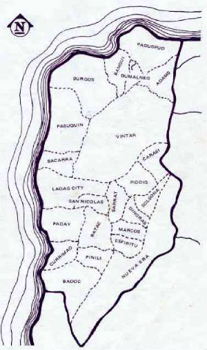